
XGRIDS Lixel L2 Pro Large sites. Longer reach.
The XGRIDS Lixel L2 Pro is a professional mobile LiDAR and SLAM scanner built for medium-to-large and complex environments, with 120 m and 300 m configurations, up to 640,000 points per second, true-colour imaging, RTK workflows, and handheld, vehicle, and UAV deployment options.

Built when the site gets bigger and harder.
The XGRIDS Lixel L2 Pro sits in the lineup as the extended-range, high-output platform for medium-to-large environments, difficult outdoor conditions, infrastructure, and projects that benefit from vehicle or UAV deployment.
Range, density and deployment flexibility.
Choose the XGRIDS Lixel L2 Pro when a lightweight interior scanner is not enough: large campuses, long corridors, infrastructure, industrial facilities, roads, mines, forestry, and outdoor environments where range and point rate matter.
Post-processed relative accuracy
Official L2 Pro v2.4 documentation lists 1 cm RMSE post-processed relative accuracy within 100 m.
Point-cloud thickness
Official documentation lists 0.5 cm point-cloud plane thickness within 10 m of the walking path.
Absolute accuracy
Real-time and post-processed horizontal / vertical RMSE with appropriate RTK or control workflows.
L2 Pro is not a single fixed scanner. Choose the LiDAR configuration around the scale, point density and sensor range required for the project.
Three configurations. One platform.
Efficient professional capture
A practical entry into L2 Pro for large building, AEC, facility and general mapping work where 120 m sensor range is sufficient.
More points across the same range
Doubles the point rate while retaining the 120 m range class — well suited to complex industrial, infrastructure, construction and large-site workflows.
Extended sensor range
Built for open environments where extended LiDAR reach matters. Useful point-cloud range still depends on reflectivity, coverage density and deployment method.
Useful data while you are still on site.
L2 Pro combines rotating LiDAR, panoramic imaging, IMU, visual positioning, SLAM and RTK workflows to produce coloured point clouds in the field and higher-accuracy results after processing.
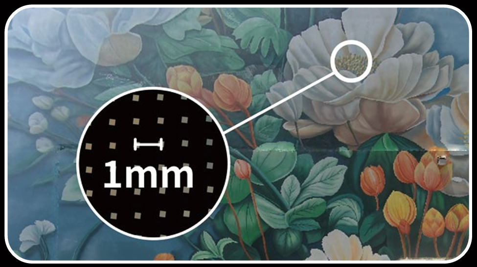
Official v2.4 documentation lists 2 cm real-time relative accuracy within 100 m.
For measurement-driven workflows, post-processing improves relative accuracy.
Horizontal and vertical accuracy with appropriate RTK/control conditions.
Plane thickness within 10 m of the walking trajectory in the documented workflow.
Capture is only the start. The XGRIDS Lixel L2 Pro connects to LixelGO, LixelStudio and LCC workflows for field control, point-cloud processing, map fusion and photorealistic 3DGS reconstruction.
One capture ecosystem. Multiple deliverables.
LixelGO
Connect to the scanner, configure the project, monitor capture and manage field workflows.
LixelStudio
Post-process point clouds, apply control / RTK workflows, enhance data and manage larger datasets.
Map Fusion
Fuse compatible ground capture segments into larger projects; current documentation supports up to 10 ground segments.
LCC 3DGS
Use handheld L2 Pro capture in XGRIDS LCC workflows for photorealistic Gaussian Splatting and spatial experiences.
Carry it. Mount it. Fly it.
The L2 Pro platform extends beyond handheld capture. True Point Precision also supports vehicle-mounted and DJI M300 / M350 aerial workflows.
Walk the site
Best for buildings, industrial facilities, campuses, complex interiors, outdoor sites and general reality-capture projects.

Map corridors faster
Purpose-built for roads, infrastructure, construction sites and large-area mobile scanning. XGRIDS recommends 20–30 km/h and supports up to 40 km/h.
Explore Vehicle Mount →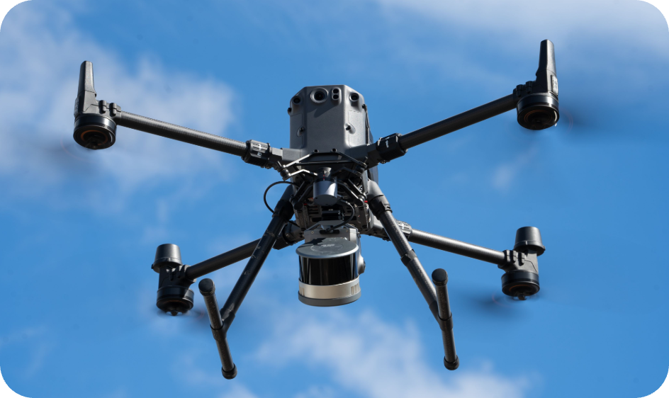
Take L2 Pro airborne
DJI SkyPort provides power and RTK data. XGRIDS recommends approximately 30 m flight height and 3 m/s for standard aerial workflows.
Explore Drone Mount →Explore XGRIDS Lixel L2 Pro applications where range, point rate and deployment flexibility matter.
Large environments. Real workflows.
Surveying & Mapping
High-output spatial capture for topographic, existing-conditions and survey-support workflows.
Construction & BIM
Document existing conditions, measure geometry and move point clouds into CAD and Scan-to-BIM.
Infrastructure
Capture bridges, transportation assets, utilities, campuses and large public works.
Industrial & Facilities
Record complex production environments, equipment layouts and facility conditions.
Roads & Corridors
Combine L2 Pro with the vehicle mount for faster corridor and mobile mapping.
Aerial Mapping
Deploy on supported DJI M300 / M350 aircraft for large or difficult-to-reach sites.
Mining & Forestry
Use extended range and high point rate in large outdoor, low-feature and terrain-heavy projects.
Heritage & Digital Twins
Create measurable records and photorealistic spatial experiences from the same capture ecosystem.
Choose around the project.
The XGRIDS lineup now covers four distinct capture needs. L2 Pro remains the range- and deployment-focused option for large, complex environments.
XGRIDS Lixel K2
Compact handheld capture for smaller and medium indoor/outdoor environments.
Explore K2 →XGRIDS Lixel L3
Validated 5 mm relative accuracy, integrated RTK, onboard display and stronger imaging.
Explore L3 →XGRIDS Lixel L2 Pro
120 / 300 m configurations, up to 640k pts/s, plus vehicle and UAV deployment.
You are hereXGRIDS PortalCam
Fast visual-spatial capture for photorealistic 3D environments and immersive delivery.
Explore PortalCam →L2 Pro becomes a broader capture platform when paired with the right mount. True Point Precision supports both vehicle and aerial deployment in Canada.
Extend the scanner beyond handheld.
XGRIDS Lixel L2 Pro Vehicle Mount
Convert the L2 Pro into a mobile LiDAR platform for roads, infrastructure and large-area capture.
View Vehicle Mount →
XGRIDS Lixel L2 Pro Drone Mount
Integrate L2 Pro with DJI M300 / M350 RTK aircraft for large or difficult-to-reach sites.
View Drone Mount →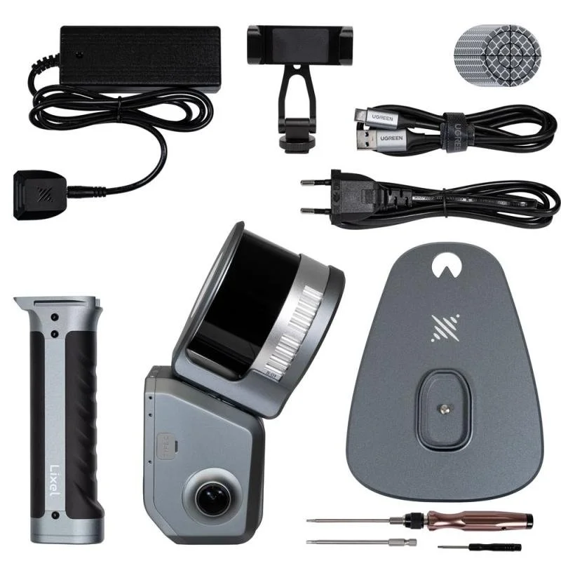
Build the right configuration
Talk with True Point Precision about batteries, control-point workflows, RTK, field accessories and deployment setup.
Configure Your System →XGRIDS Lixel L2 Pro Specifications
Specifications from XGRIDS Lixel L2 Pro v2.4 documentation. Deployment-specific specifications vary.
Vehicle and UAV modes have their own accuracy, speed and workflow limitations. Confirm the intended deployment with True Point Precision when selecting a configuration.
More than the scanner.
True Point Precision supports the complete reality-capture workflow — product selection, deployment, training, scanning services, Scan-to-BIM, software and project delivery.
Canadian product support
Choose the right L2 Pro configuration, mounting system and processing workflow for the project.
Training + implementation
Support from field capture through LixelStudio, point clouds, LCC and downstream software.
Scan-to-BIM + delivery
True Point Precision can provide scanning and project deliverables when you need the complete service.
Rentals + equipment
Use the right hardware for each project without forcing every job into one scanner or deployment method.
Questions focused on configuration, accuracy, vehicle and UAV deployment, 3DGS, and how L2 Pro now fits beside the XGRIDS Lixel L3.
Before you choose the configuration.
What XGRIDS Lixel L2 Pro configurations are available?
What is the accuracy of the XGRIDS Lixel L2 Pro?
What is the difference between the 120 m and 300 m L2 Pro?
Can the XGRIDS Lixel L2 Pro be vehicle mounted?
Can the XGRIDS Lixel L2 Pro be mounted to a drone?
Does vehicle-mounted L2 Pro support 3DGS?
Can XGRIDS Lixel L2 Pro create 3D Gaussian Splatting?
How does XGRIDS Lixel L2 Pro compare with XGRIDS Lixel L3?
Build the L2 Pro around your site.
Tell us the project scale, environment, required accuracy and deployment method. We can help select the right 120 m / 300 m configuration, vehicle or UAV mounting, RTK/control workflow and downstream processing setup.