
True Point Precision · Reality capture services
3D laser scanning
& LiDAR services.
Start with what’s there.
Capture existing conditions for renovation, retrofit, construction and facility planning. True Point Precision provides 3D laser scanning with project-scoped deliverables—from point-cloud data to Scan-to-Plan, Scan-to-CAD and Scan-to-BIM.
Real places.Practical uses.
When the next decision depends on the existing space, start with a shared spatial reference. True Point Precision supports capture for a range of site types and project needs.

Buildings & renovation
Existing-condition capture for renovation, retrofit and layout planning.

Industrial facilities
Spatial reference for complex spaces, equipment and facility planning.

Infrastructure
Capture existing structures to inform documentation and project discussions.

Construction
Document visible site conditions to support coordination and field review.
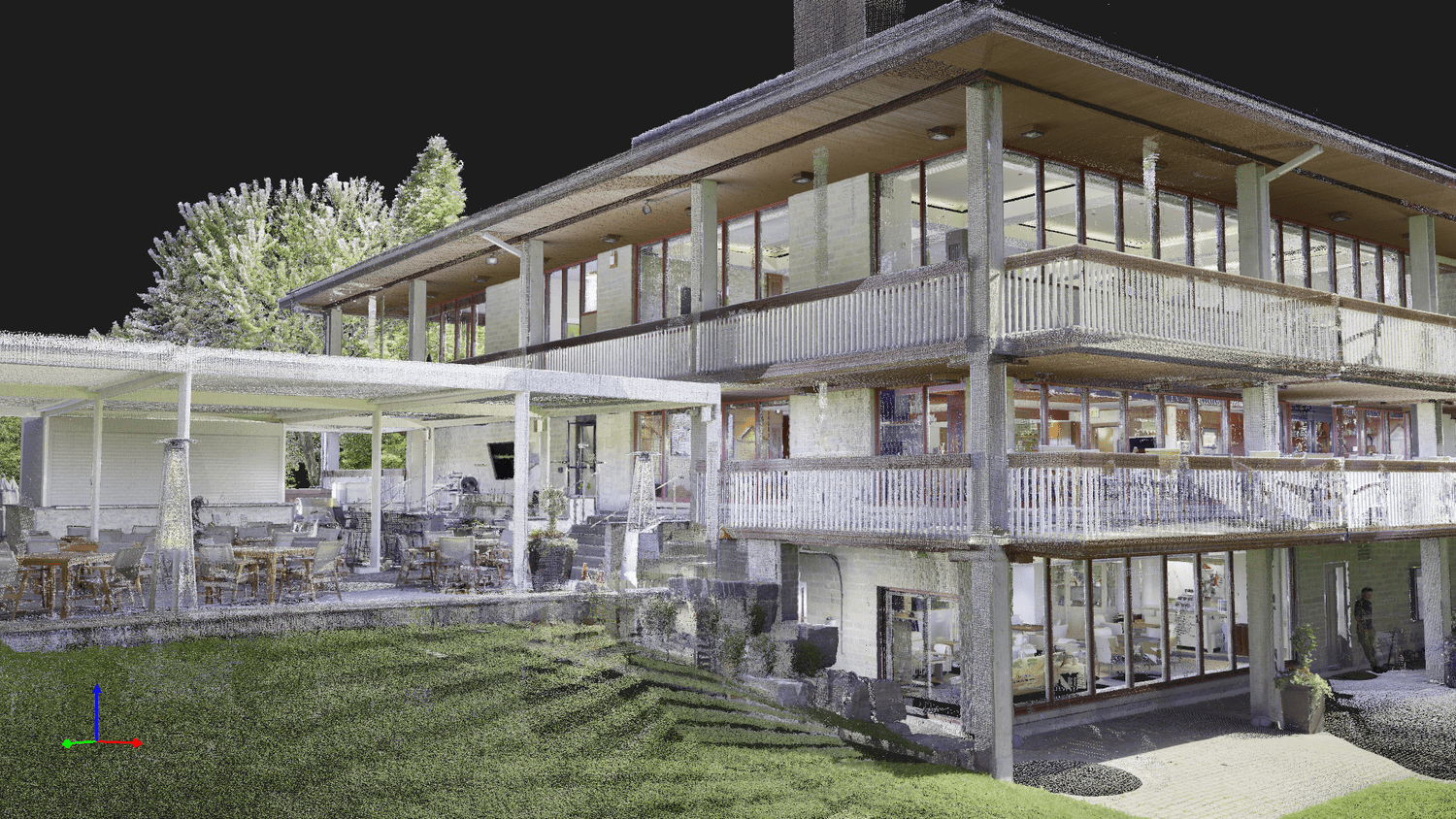
From 3D scans
to plans, CAD & BIM.
Build your as-built documentation around the way your team works. Choose the plans, drawings, models or point-cloud data your project needs, with coverage and detail agreed before work begins.
Point-cloud data
A 3D reference of captured surfaces for review and downstream workflows. Agree the required coverage, coordinate reference and file formats as part of the project scope.
Scan-to-Plan: 2D plans
Turn captured existing conditions into 2D floor plans, elevations and sections for renovation, retrofit and facility planning. Agree the drawing set, coverage and required detail for your project.
Scan-to-CAD: editable drawings
Convert point-cloud data into editable CAD drawings for downstream design and coordination. Plan and CAD deliverables can overlap; we define both the drawing content and file format around your workflow.
Scan-to-BIM modeling
Need a model as well as a scan? Discuss separately scoped Revit/BIM modeling, including the elements and level of detail your project needs.
Coordination & design support
Connect the captured conditions with planning, coordination or design work. Define the intended use and any additional deliverables before capture begins.
Your capture.
Our processing support.
Point-cloud processing & scan registration
Already have scan data? True Point Precision offers standalone processing and registration to bring captured scans into a coordinated point cloud for review and downstream use.
Share your data source, project requirements and target software. We’ll review the input, required alignment and intended outputs before agreeing the processing scope.
3D Gaussian Splat generation
Create a visual representation of a captured space with our 3D Gaussian Splatting (3DGS) generation service. We handle the generation work for customers whose computers lack the processing capacity for their projects.
Send details of your capture workflow and intended viewing platform so we can assess the source data and agree the output. A Gaussian Splat is a visual deliverable; measurement-grade point clouds, drawings and BIM models are scoped separately.
Digital transformation starts with existing conditions.
Move physical spaces into digital workflows your team can use. Connect reality capture with as-built documentation, editable drawings, BIM models and visual spatial references to support planning, coordination and remote collaboration.
From site conditions
to project context.
The right capture plan starts with the work the data needs to support.
Define the requirement
Start with the site, intended use, areas of interest and required outputs. Discuss accuracy needs, existing control, access and schedule.
Plan & capture
Plan site coverage around the agreed scope and access conditions. Capture the visible surfaces needed for the project.
Process & review
Bring the captured data into a usable spatial reference. Review coverage and discuss any gaps that affect the agreed deliverable.
Deliver & put it to work
Hand over the agreed outputs. Connect the data with separately scoped modeling, coordination or support where needed.
LiDAR scanning questions.
What is Scan-to-Plan?
Scan-to-Plan turns captured existing conditions into 2D drawings such as floor plans, elevations and sections. The drawing set and level of detail are agreed around the project.
How do Scan-to-Plan, Scan-to-CAD and Scan-to-BIM differ?
Scan-to-Plan describes the drawing output, such as floor plans. Scan-to-CAD emphasizes editable CAD deliverables, which can include those same plans. Scan-to-BIM produces a scoped building information model, including Revit models. We help define which deliverables your team needs.
Can you process and register scan data we have collected?
Yes. True Point Precision offers standalone point-cloud processing and scan registration. Share your data source, capture method, alignment requirements and target software so we can assess the data and scope the work.
Can you generate 3D Gaussian Splats if our computer is not powerful enough?
Yes. We offer 3D Gaussian Splat generation for customers who need processing support. We first review your capture workflow, source data and intended viewing platform. Generation is handled as a service; viewing requirements depend on the agreed output and platform.
What is LiDAR scanning used for?
LiDAR scanning records visible surfaces as spatial data. For buildings and sites, that data can support existing-condition documentation, planning, Scan-to-BIM and coordination. The required coverage and outputs depend on the project.
Does a scan include a Revit or BIM model?
A point cloud and a BIM model are different deliverables. True Point Precision also offers Scan-to-BIM modeling. If you need a model, include it in the inquiry so its scope and required level of detail can be discussed separately.
What accuracy and file formats can I expect?
These requirements should be agreed for your project. Share the intended use, required tolerances, coordinate reference and target software so the capture approach and handoff can be assessed together.
Can scanning capture concealed elements?
Scanning records surfaces that are visible to the sensor. Concealed or inaccessible areas may need additional access or another investigation method. Identify these requirements when discussing the scope.
What should I include in a project inquiry?
Send the site location, approximate size, areas to capture, intended use, desired deliverables, target timing and known access constraints. Existing plans or a short project brief can help explain the requirement.
Start with your site.
Define the next step.
Share the location, approximate size, intended use and target timeline. Let’s discuss what needs to be captured and how the results will support your project.