
XGRIDS Lixel K1 One-hand reality capture.
XGRIDS Lixel K1 is a compact handheld 3D scanner built for fast reality capture with 1.2 cm relative accuracy, 360° LiDAR and panoramic vision. Walk the site, confirm coverage in real time, then move into point-cloud, colour, mesh, control-point and LCC workflows.
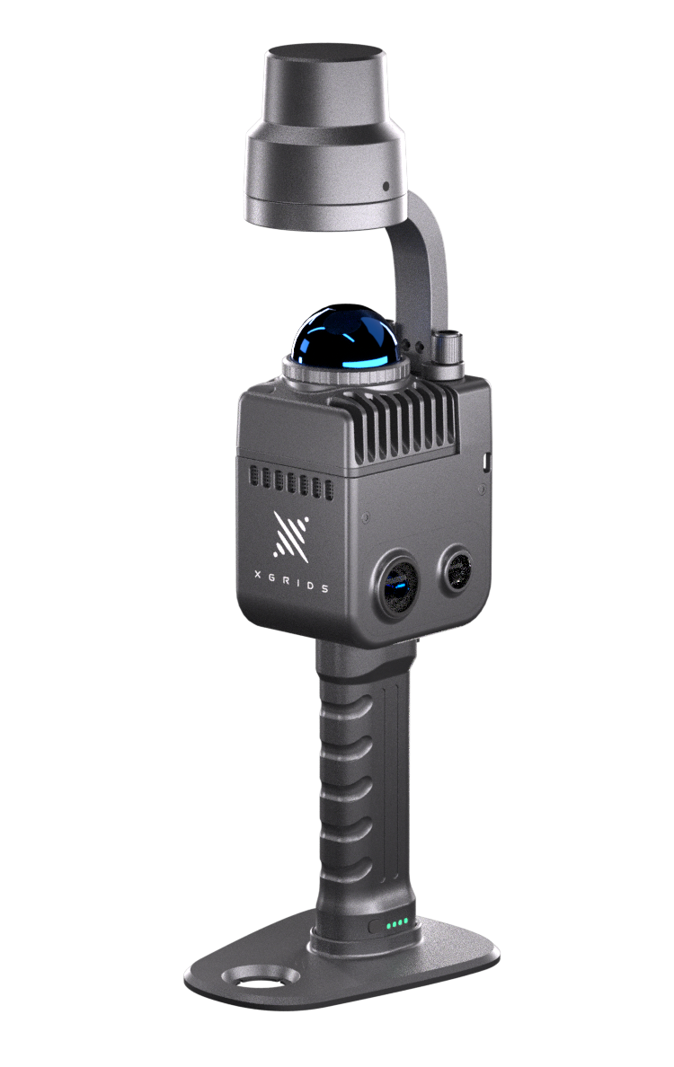
XGRIDS Lixel K1. See the scan build.
XGRIDS Lixel K1 is built around simple mobile capture: initialize the scanner, walk naturally through the environment and monitor a colourized point cloud from the connected phone. Its compact form makes it particularly useful where portability and fast setup matter.
Compact enough to carry. Serious enough for professional field work.
XGRIDS combines LiDAR, panoramic vision, inertial sensing and onboard computing in a handheld platform weighing less than 1 kg. The result is a practical scanner for existing conditions, renovation, facilities, construction, property documentation and smaller reality-capture projects.

SLAM for movement. Control when it matters.
XGRIDS Lixel K1 supports a practical progression from free-walking SLAM capture to externally controlled or RTK-referenced workflows when absolute coordinates are required.
Built for repeatable mobile reality capture.
XGRIDS currently publishes 1.2 cm relative accuracy for the XGRIDS Lixel K1. Field technique still matters: stable initialization, continuous movement, slow doorway transitions and sufficient scene features all contribute to better SLAM performance.
Use surveyed control points.
XGRIDS Lixel K1 workflows can use external control points for coordinate transformation and accuracy optimization. XGRIDS documents at least three well-distributed control points for a single controlled scan.
Capture absolute coordinates outside.
Add the XGRIDS Lixel K1 RTK module when outdoor GNSS conditions are suitable and absolute-coordinate capture is required.
40 m / 70 m
XGRIDS documents 0.1–40 m at 10% reflectivity and up to 70 m at 80% reflectivity.
Capture. Process. Use.
XGRIDS Lixel K1 is most useful when the field workflow stays simple. Capture with the scanner and LixelGO, then use LixelStudio or LCC for the level of processing the project actually needs.
Walk and monitor.
Connect the XGRIDS Lixel K1 to a phone, initialize on a stable surface and monitor the scan while moving through the site.
Process the point cloud.
Post-process complete point-cloud data, apply control or coordinate workflows, output panoramic photos and generate colour or mesh workflows.
Extend into 3DGS.
K-series capture can also feed Lixel CyberColor workflows when the project needs photorealistic 3D Gaussian Splatting rather than only engineering data.
Start with geometry. Choose the finish.
XGRIDS Lixel K1 is primarily a compact mobile mapping scanner, but the same capture can support different outputs depending on whether the project needs engineering point-cloud data, visual surface context or a photorealistic spatial model.
Point cloud
Use post-processed XGRIDS Lixel K1 data for existing conditions, CAD, measurements, sections, elevations and Scan-to-BIM workflows.
Colour + panoramic imagery
LixelStudio can output panoramic images for colourized point-cloud and mesh workflows.
Mesh
Generate a surface-oriented representation when context and visual communication matter more than raw point display.
LCC 3DGS
Use compatible K-series captures with Lixel CyberColor for 3D Gaussian Splatting workflows.
XGRIDS Lixel K1. Built for your industry.
XGRIDS Lixel K1 is strongest when the job benefits from compact handheld capture, rapid setup and centimetre-level mobile mapping rather than the greater range or higher precision of larger XGRIDS systems.

AEC & Scan-to-BIM
XGRIDS Lixel K1 · Existing conditions + Scan-to-BIM
Capture existing conditions for renovation, retrofit, BIM modelling, drawings and dimensional documentation.

Construction
XGRIDS Lixel K1 · Progress + site documentation
Document progress, existing geometry and spaces before work is covered, modified or difficult to access again.

Industrial & Facilities
XGRIDS Lixel K1 · Facility + asset records
Record equipment layouts, facility conditions, production spaces and spatial information for planning and maintenance.

Surveying & Geomatics
XGRIDS Lixel K1 · Control + coordinated positioning
Use ground control or the optional RTK module when a compact mobile workflow also needs coordinated positioning.

Heritage & Existing Conditions
XGRIDS Lixel K1 · Heritage + preservation
Capture geometry and visual context for historic documentation, renovation planning and preservation workflows.

Property & Digital Twins
XGRIDS Lixel K1 · Property + spatial records
Build measurable spatial records for property documentation, renovation planning, digital twins and immersive review.
Start with the deliverable.
XGRIDS Lixel K1 remains a useful compact option, but the right XGRIDS scanner depends on required accuracy, range, site size, deployment method and whether the final result is engineering data or visual spatial content.
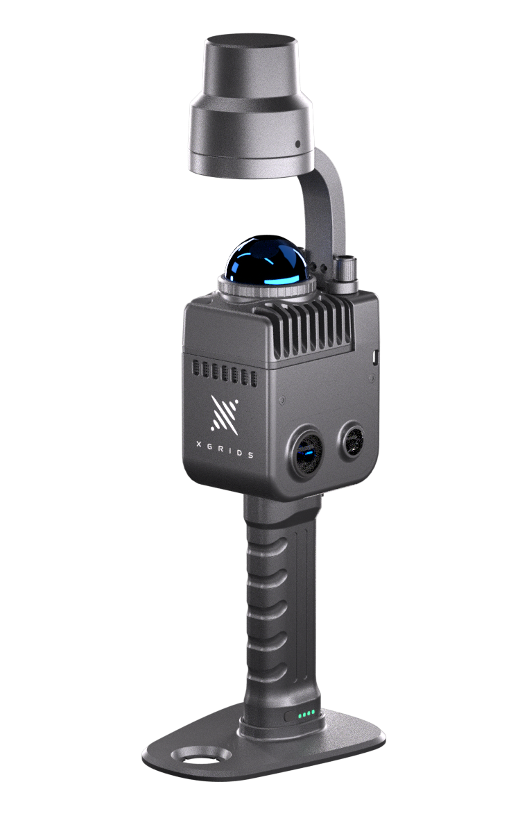
Compact + one-handed
1.2 cm published relative accuracy, 360° LiDAR, panoramic vision and optional RTK for portable reality capture.
XGRIDS Lixel K1 · You are here
Newer lightweight workflow
1 cm-class relative accuracy, built-in RTK and the newer compact K-series platform for everyday engineering capture.
Explore XGRIDS Lixel K2 →
Higher precision
Validated 5 mm relative accuracy, integrated RTK, high-quality true-colour imaging and point cloud / mesh / 3DGS workflows.
Explore XGRIDS Lixel L3 →
Range + deployment flexibility
120 m and 300 m configurations for larger sites, plus handheld, vehicle and supported DJI M300/M350 workflows.
Explore XGRIDS Lixel L2 Pro →
Visual-first 3DGS
Use XGRIDS PortalCam when photorealistic spatial presentation is more important than a conventional engineering point cloud.
Explore XGRIDS PortalCam →Core field kit. Add positioning when needed.
XGRIDS package contents can change by market and package level. True Point Precision will confirm the current Canadian package before order. The core XGRIDS Lixel K1 system typically includes the scanner, battery system, phone mount, GCP collection plate, cable, protective cover and transport case.

XGRIDS Lixel K1 Specifications.
Current reference assembled from XGRIDS’ public XGRIDS Lixel K1 page and v2.4 product documentation. Verify current package-level hardware and software details at time of order.
Choose the scanner. Build the workflow.
True Point Precision supports hardware selection, demonstrations, field methodology, XGRIDS software, control/RTK workflows and downstream reality-capture deliverables across Canada.
XGRIDS Lixel K1 or the newer XGRIDS Lixel K2?
We can compare XGRIDS Lixel K1 against XGRIDS Lixel K2, XGRIDS Lixel L3, XGRIDS Lixel L2 Pro and XGRIDS PortalCam based on your actual deliverable and site conditions.
LixelGO + LixelStudio + LCC
Get the field and processing workflow set up around the outputs your team really needs.
Scanning + Scan-to-BIM
True Point Precision also provides project-based scanning, modelling and digital-twin services.
Sales, rentals + support
Hardware and workflow support for customers across Canada, with current availability confirmed at time of inquiry.
Know where XGRIDS Lixel K1 fits.
XGRIDS Lixel K1 is a compact professional SLAM scanner. The main buying question is not whether it can scan — it is whether its accuracy, range and optional positioning workflow are the right fit compared with the newer XGRIDS Lixel K2, higher-precision XGRIDS Lixel L3, or longer-range XGRIDS Lixel L2 Pro.
What is the published relative accuracy of the XGRIDS Lixel K1?
What is the scanning range of the XGRIDS Lixel K1?
Does the XGRIDS Lixel K1 support RTK?
Can XGRIDS Lixel K1 use ground control points?
Does XGRIDS Lixel K1 create colour point clouds?
Can XGRIDS Lixel K1 data be used for mesh and 3D Gaussian Splatting?
What is the XGRIDS Lixel K1 environmental rating?
How is XGRIDS Lixel K1 different from XGRIDS Lixel K2?
Put XGRIDS Lixel K1 into your workflow.
Tell us what you are scanning, the size of the site, the required accuracy and the final deliverable. We can confirm whether XGRIDS Lixel K1 is still the right fit or whether XGRIDS Lixel K2, XGRIDS Lixel L3, XGRIDS Lixel L2 Pro or XGRIDS PortalCam better matches the workflow.