
XGRIDS PortalCam Capture space. Keep the feeling.
XGRIDS PortalCam is a visual-first spatial camera built around photorealistic 3D Gaussian Splatting. Walk naturally through a location, process the capture in LCC, and turn real spaces into interactive 3D environments for property, film, VFX, XR, spatial content and digital experiences.

Visual-first spatial capture.
PortalCam is not positioned as an engineering point-cloud scanner. XGRIDS designed it around photorealistic 3D Gaussian Splatting for spaces where visual presence, perspective and immersive presentation matter most.
Capture a place as an experience — not just a collection of photographs.
Walk the space naturally while PortalCam combines LiDAR with a four-camera array. Process the capture in LCC and create a navigable 3D Gaussian model that preserves appearance, lighting and spatial context.
Use the XGRIDS Lixel range.
Current XGRIDS documentation recommends the Lixel K series or L2 Pro when the required deliverable is engineering point-cloud or mesh data.
PortalCam's official workflow is simple: capture the space naturally, process the data into a 3D Gaussian model, then edit, measure, annotate, publish or integrate the result into a broader content pipeline.
Three steps from space to experience.

Walk naturally
Move through the environment while PortalCam records. Use LCC Scan to control and monitor the capture.

Build the 3D model
Use LCC Studio to reconstruct the captured environment as a photorealistic 3D Gaussian Splatting model.

Edit. Share. Experience.
Edit, measure, annotate and publish LCC models, or integrate the spatial content into existing creative and immersive pipelines.
Capture once. Use the space differently.
XGRIDS PortalCam turns real locations into photorealistic 3D experiences for real estate, film/VFX, and immersive content, gaming and XR.

Let people understand the property before they arrive.
Create true-to-life spatial replicas that buyers, owners and stakeholders can navigate naturally. Preserve lighting, perspective and spatial relationships in a way flat photography cannot.

Bring the location back to the production team.
Capture sets and locations for remote review, previsualization, lighting, blocking and virtual-production planning. A spatial replica can reduce unnecessary return trips while giving departments a common reference.

Turn physical locations into reusable spatial content.
Build navigable real-world environments for immersive web, XR, gaming, interactive storytelling and creative spatial applications. PortalCam is designed to make world capture far more accessible.
PortalCam is intentionally different from the engineering-focused XGRIDS scanners. The current PortalCam workflow exports LCC and PLY model data; pure engineering point-cloud export is not currently supported.
A visual model you can move through.
Photorealistic 3D Gaussian Splatting
PortalCam captures LiDAR and imagery together so LCC can reconstruct photorealistic spatial scenes with realistic perspective changes as the viewer moves.
LCC Scan
Connect, control and monitor PortalCam during scanning.
LCC Studio
Reconstruct, edit and work with the 3D Gaussian model.
Not the main PortalCam role
If the deliverable is a conventional engineering point cloud or mesh, use XGRIDS Lixel K2, Lixel L3 or Lixel L2 Pro instead.
LiDAR for structure. Cameras for appearance.
PortalCam combines a high-rate LiDAR system with two fisheye and two front-facing cameras so the spatial model has both geometry and rich visual information.
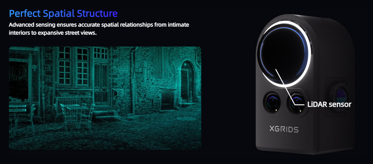
856,000 points / second
180° × 180° LiDAR field of view with Class 1 940 nm laser. Documented range is 0.1–30 m at 10% reflectivity and up to 60 m at 90% reflectivity.
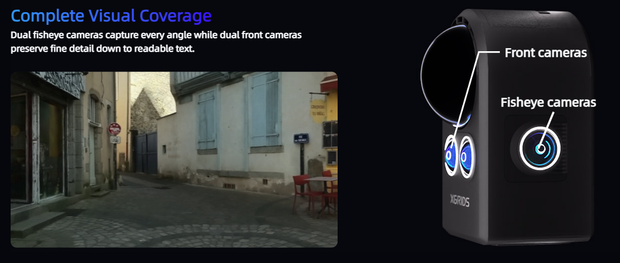
Four 4000 × 3000 cameras
Two fisheye cameras provide 200° × 200° fields of view while two front cameras provide 100° × 85°. All use 1/2-inch CMOS sensors.
Current technical reference based on XGRIDS' PortalCam product page and v1.3 product documentation.
Compact hardware. Serious spatial capture.
Ready for field capture.
The current XGRIDS package includes the core hardware needed to start capturing. LCC software options vary by package, so confirm the current software term and package level with True Point Precision when ordering.
Build the workflow, not just the capture.
True Point Precision supports PortalCam selection, onboarding, LCC workflows and downstream spatial-content strategy — plus the wider XGRIDS scanner lineup when your project needs engineering deliverables.
Canadian product support
Talk to a team that works directly with the broader XGRIDS reality-capture ecosystem.
LCC onboarding
Get PortalCam from field capture through reconstruction, viewing and delivery.
PortalCam or Lixel?
We can help determine whether your real requirement is photorealistic spatial content or engineering data.
Spatial + BIM expertise
True Point Precision works across 3D scanning, Scan-to-BIM, reality capture and digital-twin workflows.
The key questions are less about raw scanner accuracy and more about understanding where PortalCam fits compared with the engineering-focused Lixel products.
Choose XGRIDS PortalCam for the right kind of output.
What is XGRIDS PortalCam?
Does PortalCam create engineering point clouds?
What file formats does PortalCam support?
What software does PortalCam use?
How long does PortalCam run on one battery?
What is PortalCam's LiDAR range?
What cameras are inside PortalCam?
How is PortalCam different from XGRIDS Lixel K2, Lixel L3 and Lixel L2 Pro?
Walk through a PortalCam capture.
Tell us what you're trying to capture and how you want people to experience it. We'll show you where PortalCam fits — and where another reality-capture tool may be the better choice.