
Capture a place.
Bring it back
as a world.
Photorealistic spatial capture built around 3D Gaussian Splatting.
PortalCam combines LiDAR and a four-camera vision system to turn real environments into immersive spatial models you can walk through, edit, publish, and reuse. It is built for visual experience first — from virtual production and real estate to digital twins, immersive storytelling, and spatial content.

Not a panorama.
A place you can enter.
A traditional 360° tour lets you look around from fixed viewpoints. PortalCam captures spatial structure and visual detail together, producing a 3D Gaussian Splat environment that can be explored with continuous movement through the scene.
Capture once.
Explore from anywhere.
Walk the environment at normal capture speed, process the scene in LCC Studio or LCC Cloud, and publish a photorealistic spatial experience instead of a series of disconnected viewpoints.
Real spatial relationships
LiDAR and SLAM preserve the geometry needed to move naturally through the captured environment.
Visual detail that feels real
Four cameras capture broad coverage and fine visual information for high-quality spatial reconstruction.
Walk. Process.
Step inside.
PortalCam is designed around a straightforward spatial-content workflow rather than a conventional tripod-to-tripod scanning process.
Walk the space
Use PortalCam with the LCC Scan app to capture the environment as you move through it.
Build the 3DGS scene
Process the capture in LCC Studio or compatible cloud workflow to reconstruct a photorealistic spatial model.
Publish, edit & reuse
Share the environment, bring it into spatial/creative workflows, or reuse the location as a digital asset.
More than a camera.
More than LiDAR.
PortalCam combines depth, visual coverage, and spatial computing so the finished result has both structure and photorealistic appearance.
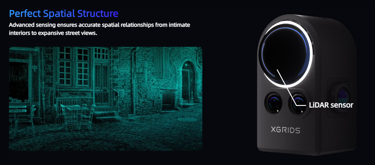
LiDAR spatial foundation
Depth sensing establishes spatial relationships across interiors and exterior environments.
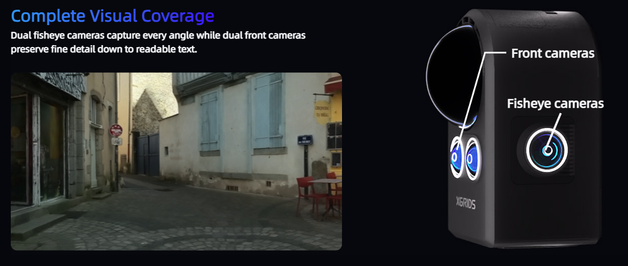
Four-camera visual coverage
Dual fisheye cameras capture broad context while dual forward cameras preserve finer scene detail.
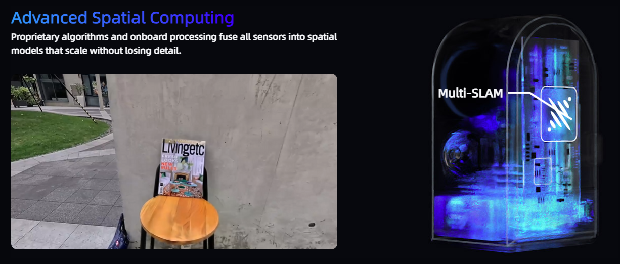
Spatial reconstruction
Sensor fusion and SLAM combine captured information into a coherent spatial dataset ready for 3DGS reconstruction.
Want to see a real PortalCam capture?
We can show you the capture workflow, processing, and finished 3DGS result before you decide if PortalCam fits your use case.
Don't show a screenshot.
Let them walk through it.
This should become the strongest part of the page. Add your own interactive PortalCam model, one short capture video, and one polished output example.
Capture a location once.
Use it many ways.
PortalCam is strongest where visual presentation and spatial experience are the priority. For engineering point-cloud deliverables, K2 or L2 Pro are usually the better fit.
Real Estate & Property
Create immersive property experiences that let remote viewers move naturally through the space.
Film & Virtual Production
Capture locations for scouting, previsualization, blocking, LED-wall workflows, and reusable digital sets.
Immersive Content
Build navigable real-world scenes for web, VR, AR, creative experiences, and spatial storytelling.
Visual Digital Twins
Create a highly visual spatial reference for facilities, documentation, remote collaboration, and presentation.
Not every "3D tour"
is actually spatial.
PortalCam is designed for continuous spatial exploration rather than fixed panoramic viewpoints or small-room phone scans.
| Approach | PortalCam | 360° Camera | Phone 3D Scan | DSLR Photos |
|---|---|---|---|---|
| Result | True 3D spatial model | Flat panoramas on spheres | Depth-map / limited 3D | Static imagery / photogrammetry workflow |
| Navigation | Move freely through space | Jump between fixed points | Limited by capture | No native exploration |
| Coverage | Interior + exterior environments | Primarily viewpoint based | Small rooms / objects | Depends on photo coverage |
| Primary use | Spatial experiences + 3DGS | Virtual tours | Quick small-scale capture | Photography / reconstruction |
Not sure if PortalCam or LiDAR is the better fit?
Tell us the deliverable you need. We’ll help you choose between PortalCam, K2, and L2 Pro based on the actual project.
Visual-first or engineering-first?
PortalCam is built for photorealistic spatial presentation and 3D Gaussian Splatting. If your primary deliverable is engineering point-cloud or mesh data for measurement, design, and BIM, ask us about the Lixel K2 or Lixel L2 Pro instead.
Spatial experience first
3DGS, immersive walkthroughs, property, production, visualization, and spatial content.
Engineering data first
Point clouds, measurement, BIM, survey, industrial capture, and engineering workflows.
PortalCam
specifications.
The hardware underneath the spatial experience: LiDAR, four-camera vision, local storage, wireless connectivity, and a portable battery-powered form factor.
Physical
LiDAR
Vision & Data
PortalCam
FAQ.
Common questions about output, workflow, capture, and where PortalCam fits relative to engineering scanners.
What does PortalCam create?
Is PortalCam an engineering point-cloud scanner?
What software is used with PortalCam?
How long can PortalCam scan on one battery?
Can I see a PortalCam model before buying?
Walk through a PortalCam capture.
Tell us what you're trying to capture and how you want people to experience it. We'll show you where PortalCam fits — and where another reality-capture tool may be the better choice.